Why is it called Bushy Park? A Kilkenny man, Arthur Bushe, built a ‘Bushes House’ here in 1700 and subsequently extended the estate. In 1772 the name was changed by another owner to Bushy Park, possibly after the London Park of that name which we know these days as the spiritual home of Parkrun. The Shaw family afterwards took ownership – George Bernard Shaw was a distant relative – and they ran the estate until the early 1950’s when they sold it to Dublin Corporation.
The Park is very much noted for its woodland and river walks, along with its ornamental ponds.
The Duck Pond has an island in the centre and many ducks and swan’s nest there. Species in the area include mallard, mute swans, tufted duck, moorhen, coot, little grebe and the kingfisher.
The ‘Shell House’ nearby is a curious little ruin. It is decorated inside with shells (mainly cockle) collected from many Dublin beaches but much of the plaster has fallen away along with many of the shells.
The estate was once much bigger than it is now. It was mostly used for farming and parts were leased to tenants. Bushy Park House is now no longer in the grounds of what we know now as Bushy Park.
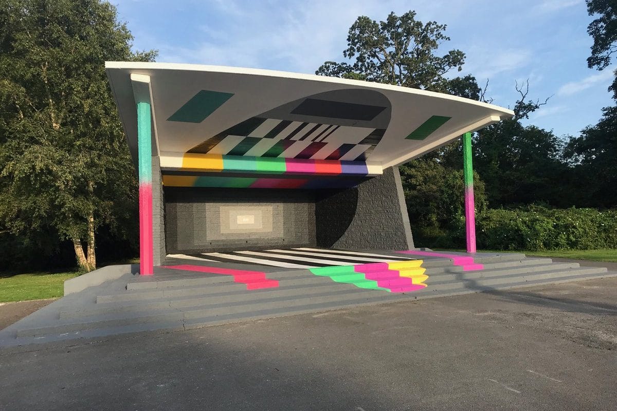
I have no date for the building of the bandstand but I can only assume it was there when the park was opened in 1960. According to the builtdublin.com website, at that time the park included two pavilions, 16 hard courts, pitches for Gaelic, football and Hockey and the bandstand.
Over the years the bandstand has remained idle but its aesthetics within its natural amphitheatre-like setting are admired. You may have noticed that since 2019 a new painted mural has appeared at the Bandstand site.
The project named “Please Stand By” is a collaboration between Dublin Art group Subset and the Park and is inspired by the fact that the bandstand has remained unused over many years. You can read all about the concept in the link here;
There are fifteen different native trees in the park and its worth taking a look at this guide to them along with a map of where they can be found in Bushy. It might be a fun activity to explore if you have kids. Sometimes when we’re doing the sessions it’s easy for the trees to become hidden in plain sight.
A lovely map dates from 1879 and is part of Dublin City Councils Shaw map collection.
In the close-up below from the 1879 map, I’ve marked the area where I think the Club House is now with a circle, where there appear to have been some trees.
The wooded area further to the right is where the duck pond is now. I’ve seen some maps where this area appears to be a marshy looking area alongside the Dodder. The reason for this is that this area surrounding the duck pond, stretching up to the hill, where we do the Hills and Sprints session above the bandstand, was at one time the flood plain for the Dodder before the water level was dropped by the nineteenth century drainage commissioners.
If you compare the three later maps covering the same area – the first one is the current view with the club house marked with an ‘x’ (or at least where I think it is) with the duck pond to the east. Then there is a map from 1821 you can see that the river Dodder appears much wider with no sign of an ornamental pond. In the last map from 1938 there is still no sign of the duck pond.
I have been unable to find a date for the building of the ornamental ponds in Bushy Park. The above suggests them to be quite a relatively recent 20th century addition. The Duck pond doesn’t appear even on a 1942 map I have seen. The current park was opened in 1960 and I wonder if the ponds and bandstand were built around that time? If anybody knows, I would appreciate it if you could let me know.
The Rivers Dodder & Poddle – Dublin City Council – McEntee & Corcoran
Our Good Health, a History of Dublin’s Water & Drainage – Corcoran
Rathfarnham – Curtis
Down the Dodder – Moriarty
http://www.dublincity.ie/dublin-buildings/bushy-park-house
http://builtdublin.com/bandstand-bushy-park-terenure-dublin-6/


